appalachian Trail 2017


Feb 7th 2017

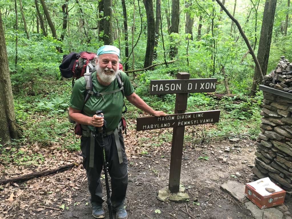
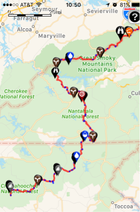
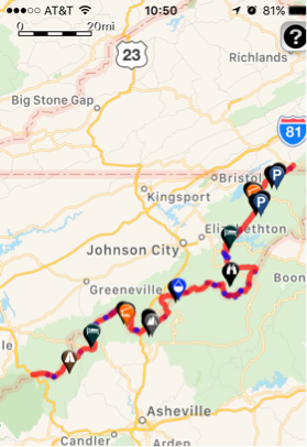
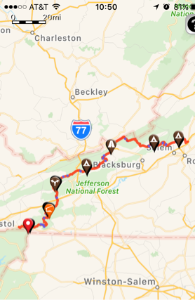
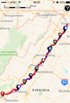
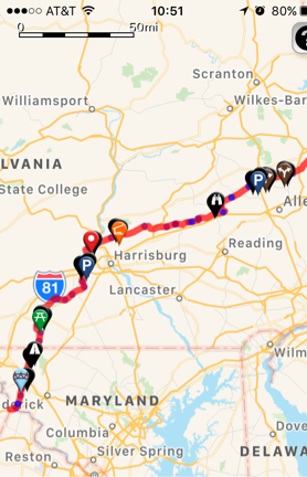
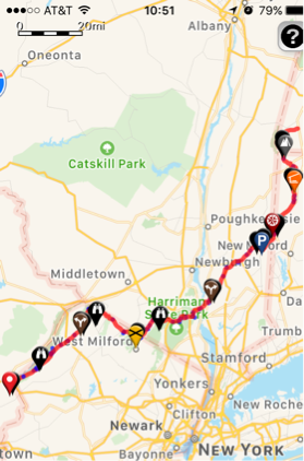
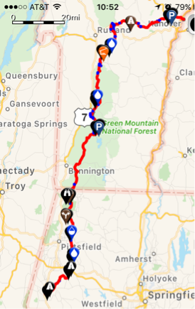
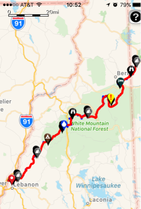
150 days into the adventure!!!
HARD FALLS 30
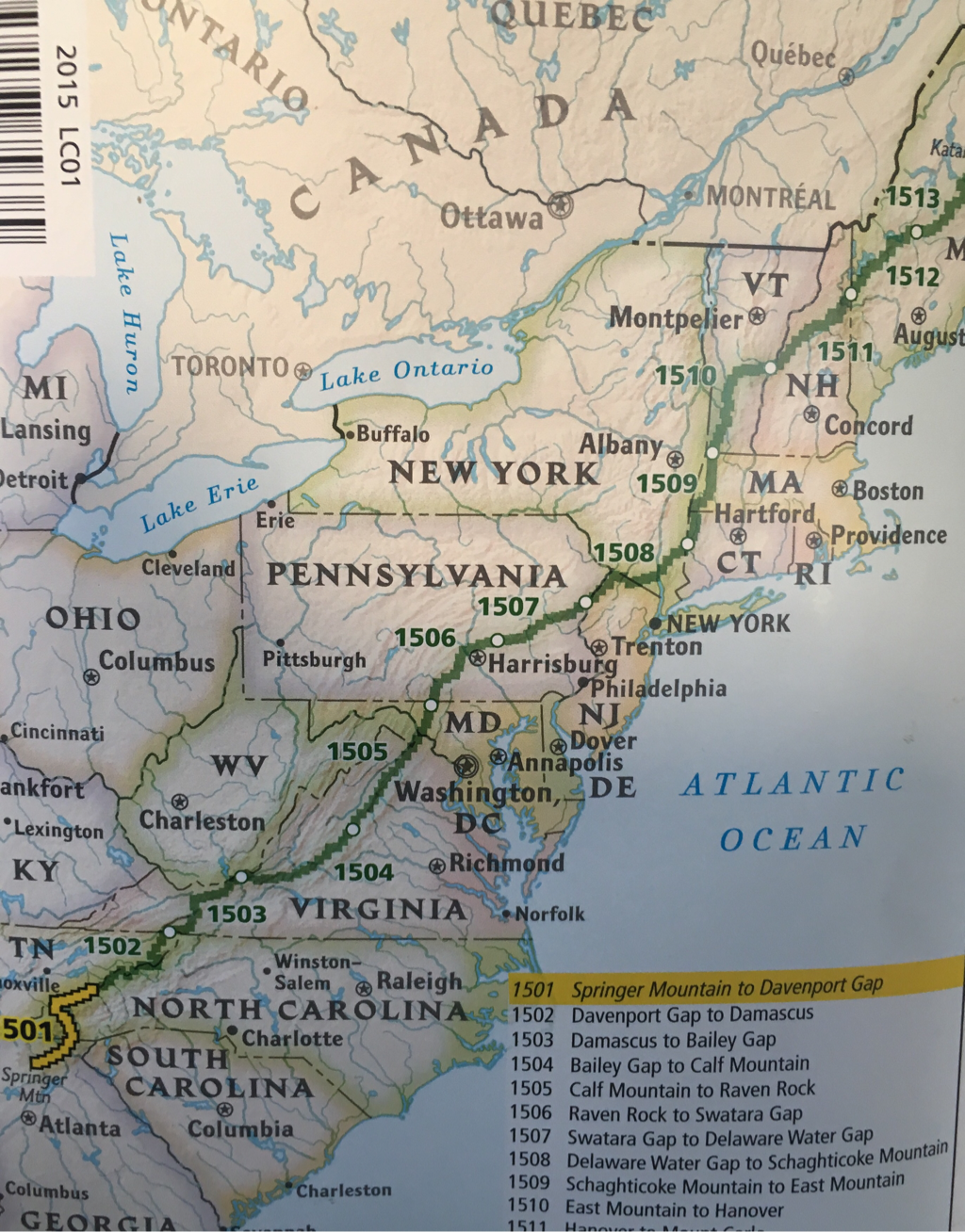
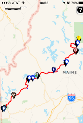
updates check menue and then click on Maine, New Hampshire, Vermont, Massachusetts, Connecticut,New York, New Jersey, Pennsylvania, Maryland, West Virginia, Virginia, Tennessee, North Carolina or Georgia!!!
Want to thank Norman, my brother-in-law who has been a wealth of information. Also Patti who has helped so much!
Jason at Mountain Crossing; knowledgeable employee who was very helpful!
Jason at Mountain Crossing; knowledgeable employee who was very helpful!
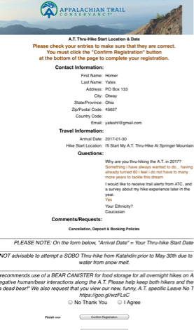
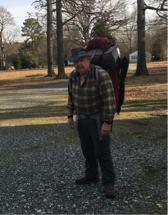
02/07/2017 left Virginia for Springer Mountain Georgia
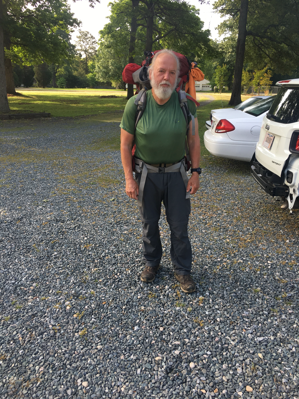
05/10/2017 Visited Virginia after arriving at Waynesboro Virginia 3 months and 40 lbs lighter
check menu bar for updates:
"Getting Started"

02/07/2017
Departing Richmond Virginia for Gainesville Georgia... should be on the trail prior to 12:00 noon on 09/02/2017... happily this falls into my +- 2 weeks... excited as hell to plant my feet on the trail.... great to work on making a dream happen, the research, planning, doubts, support, stumbling blocks, finances... still the doubt is there... it is a great feeling getting questions from my brother-in-law and realizing I can check that block off, or being able to say no, i do not need that, already have it... never turn down the knowledge of those wiser than you... better to be embarrassed at a kitchen table than over a cat hole with no toilet paper!!!!
Departing Richmond Virginia for Gainesville Georgia... should be on the trail prior to 12:00 noon on 09/02/2017... happily this falls into my +- 2 weeks... excited as hell to plant my feet on the trail.... great to work on making a dream happen, the research, planning, doubts, support, stumbling blocks, finances... still the doubt is there... it is a great feeling getting questions from my brother-in-law and realizing I can check that block off, or being able to say no, i do not need that, already have it... never turn down the knowledge of those wiser than you... better to be embarrassed at a kitchen table than over a cat hole with no toilet paper!!!!
SHUTTLE arranged for a ride from the hotel in Gainesville Georgia to the top of Springer Mountain on 9 Feb. cost to be split should anyone else show up is $100.
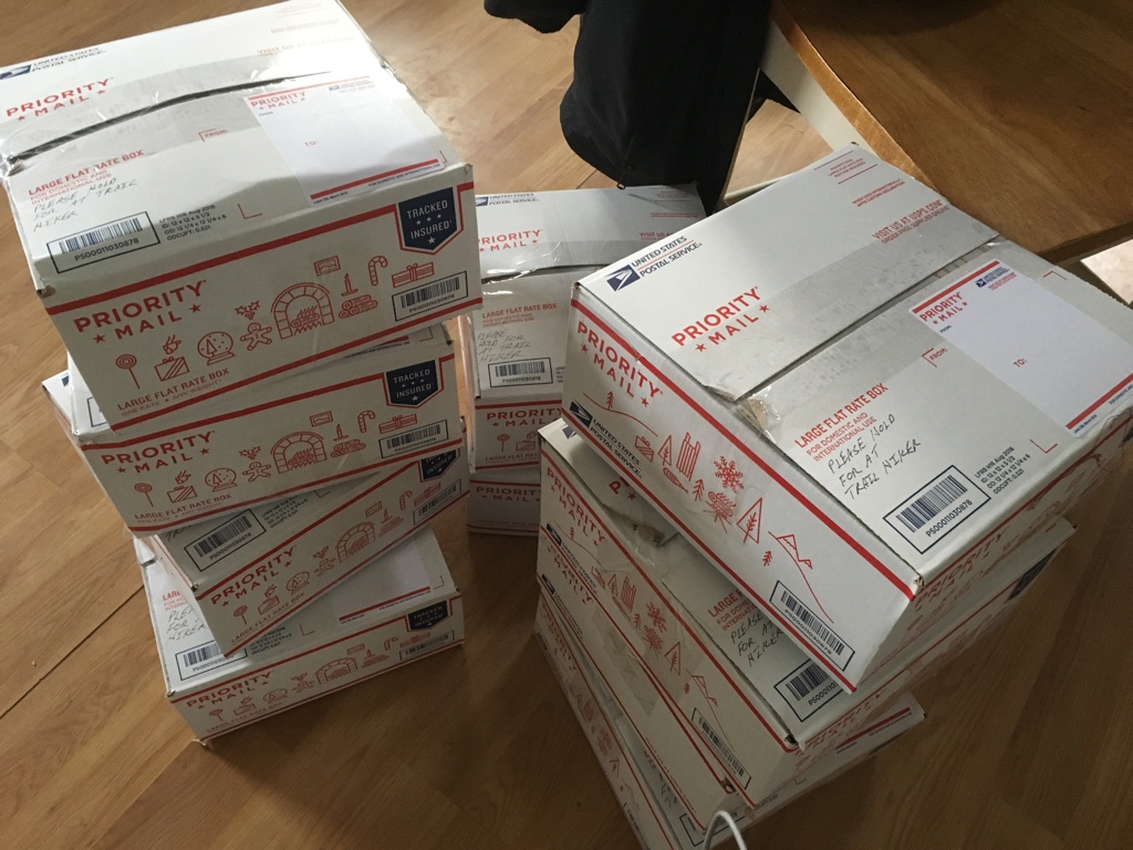
boxes packed and ready to mail, expect to have one mailed every 10-20 days depending on projected access to stores along the trail
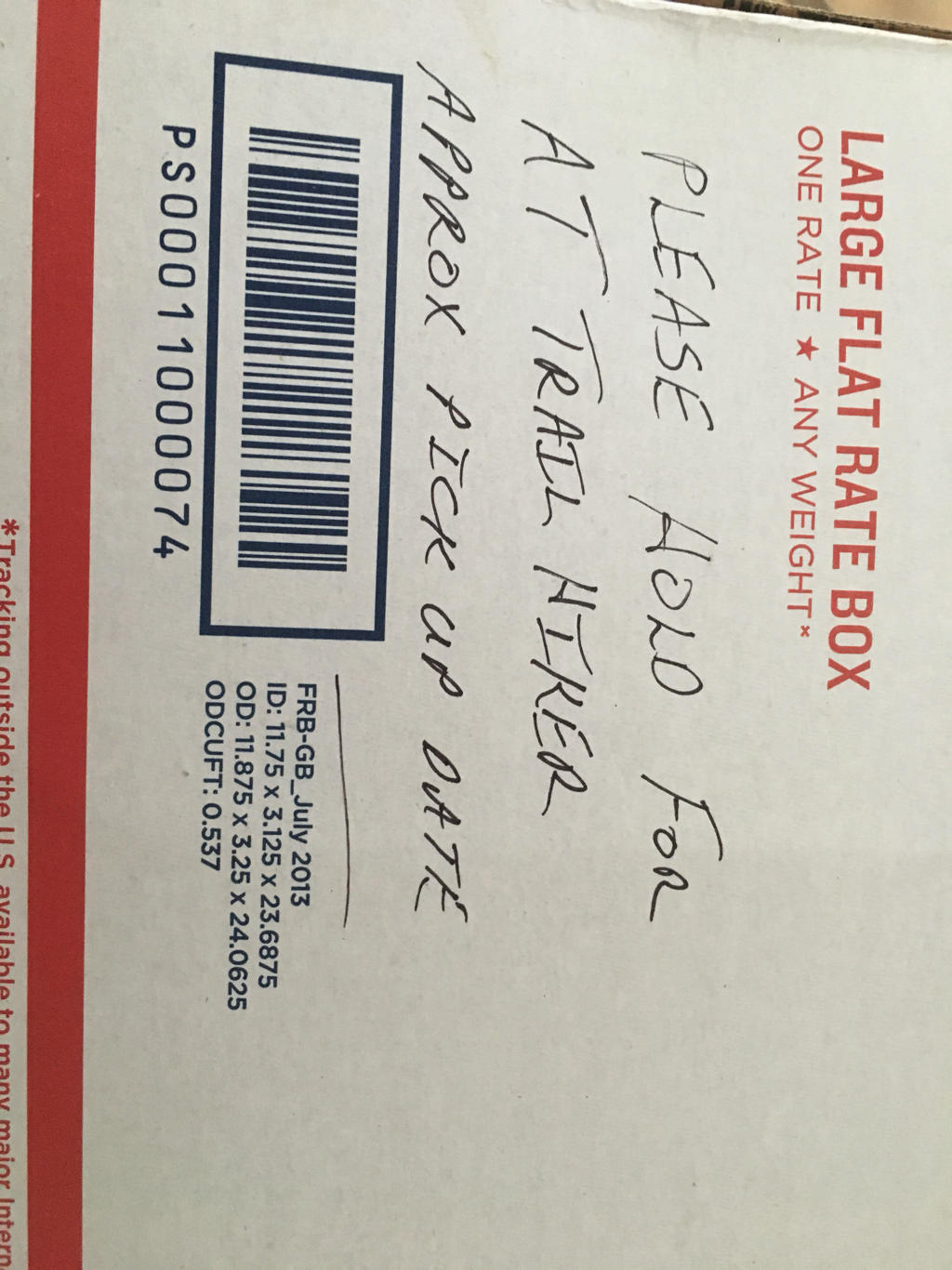
most places will hold a package for 30 days... it is nice to put a projected date of arrival on the box as well as a phone number...
soruck.net is a great site for mailing information, it has been put together well and is very user friendly... this site can be used to print labels, it lists hostels, post offices as well as other places to drop packages... I highly recommend checking it out and supporting the site
soruck.net is a great site for mailing information, it has been put together well and is very user friendly... this site can be used to print labels, it lists hostels, post offices as well as other places to drop packages... I highly recommend checking it out and supporting the site
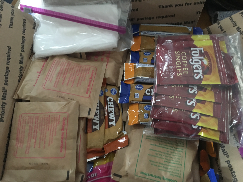
basic supplies; the cost of mailing this box is $18.75 a flat rate, it contains items that have been broken down from larger packages to reduce weight between points... not a perfect solution and one that I need to learn more about... mailing these hopefully will keep me from leaving the trail for a town or store to purchase supplies... many of the packages get mailed to hostels along the trail
26 January 2017
Reservations with Amtrak on 5 February for Richmond Virginia; visit sis for a couple days then depart for Gainesville Georgia on 7 February, hope to be on the trail the morning of the 9th
Reservations with Amtrak on 5 February for Richmond Virginia; visit sis for a couple days then depart for Gainesville Georgia on 7 February, hope to be on the trail the morning of the 9th
17 January 2017
In Ohio at Ethan's... finished up with Amazon 22 December 2016... The weather is really looking good for an early start, will know more in a week or two. Waiting on my W2 from Amazon so I can file my tax prior to departing. Stopping in Richmond Virginia to visit my sister and then on to Georgia... went to Hawks Nest in West Virginia over the long weekend, got an idea what the trails would be like, will take some adjusting, conditioning as I expected but that is fine, the weather is cool which is a great advantage. Boxed up 10 boxes of food to be mail as needed, locations to be determined... using large priority boxes from the post office, pay one price no matter what the weight is.
In Ohio at Ethan's... finished up with Amazon 22 December 2016... The weather is really looking good for an early start, will know more in a week or two. Waiting on my W2 from Amazon so I can file my tax prior to departing. Stopping in Richmond Virginia to visit my sister and then on to Georgia... went to Hawks Nest in West Virginia over the long weekend, got an idea what the trails would be like, will take some adjusting, conditioning as I expected but that is fine, the weather is cool which is a great advantage. Boxed up 10 boxes of food to be mail as needed, locations to be determined... using large priority boxes from the post office, pay one price no matter what the weight is.
30 January is approaching rather quickly for me, I have registered to start the AT on that day, still a plus or minus two week window. Sadly I am attempting to see if i may need to go around portions of the trail near Gatlinburg Tennessee because of damage caused by fires, many started by a suspected arsonist. Very doubtful the fires will still be burning in January, but access to parts of the trail may be hindered...
Work at Amazon is coming to an end for the season, overtime this season has been difficult to obtain, some of it even cancelled... nothing to do with the economy that I am aware of, a remodeled distribtion center with a focus on different merchandise than last year...
With the season coming to an end it is time to start packing things away... searching for items that i will take with me to Ohio prior to catching a ride to Atlanta...
DECEMBER 2016
paragraph from an article in an Atlanta paper
The Appalachian Trail is closed in parts of Georgia and North Carolina. Campfires have been banned in the 655,598-acre Cherokee National Forest that straddles the North Carolina-Tennessee line with stretches both north and south of the Great Smoky Mountains National Forest, which is also closed to burning.
Just received this email on 1 December 2016
after the above update
Hi Homer,
Thank you for registering your A.T. thru-hike. Please be advised that ~70 miles of A.T. are currently closed from US76 at Dicks Creek Gap near Hiwassee, GA, north to US74 at the Nantahala River in Wesser, NC, and as of this week all of Great Smoky Mountains National Park, including the A.T., was closed, all due to forest fires. The A.T. will not reopen until the US Forest Service or NPS says it is safe and we have no current prediction when that might occur.
It is quite possible that some sections will still be closed when you begin your northbound thru-hike, so you should be prepared to skip around closed A.T. sections.
Since the drought is predicted to continue into February, forest fire danger will continue for the foreseeable future. All campfires are banned from Amicalola Falls State Park north to Front Royal, Virginia; smoking is also highly discouraged; and there may be additional Trail closures, as there were this week. The use of commercially available portable lanterns, stoves, or heating equipment that utilize gas or pressurized liquid fuel is allowed. The stove must have an ON/OFF switch (No alcohol stoves, no hexamine or solid fuel cubes).
The forest fires are due to a historic drought and that also means that there is very little water available along the A.T. as most of the springs have dried up in GA, NC and TN. And... it can get VERY cold in the Smokies and Roan Highlands during January, February and March with temperatures as low as -40 degrees with deep snow (I hope!).
So before you start your NOBO thru-hike, please check our Trail Updatespage for the latest information, and feel free to give us a call or e-mail to get current conditions.
Best,
http://www.appalachiantrail.org/home/explore-the-trail/trail-updates
N2Fitness in Campbellsville Kentucky was a great place to workout... while i was limited in the days i could workout the gym was clean, had good equipment and great owners... it was never overcrowded allowing for easy access and great workouts...
Homer Yates
[email protected]
Thanksgiving 2016!!! 24 November
January 30th is quickly approaching. I have registered to start my thru hike, purchased the gear needed, started boxing up food... watching long range weather forecast... looking into storage of my RV, Amtrak ticket to the Atlanta area and a shuttle from the station to Springer Mountain... so things are coming together, still not rushing, testing equipment, learning how it works etc...
(AS I RESEARCH THIS I CONTINUE TO ADJUST MY PLANS), already reduced anticipated miles per day by half, that has me anticpating 200 days of hiking, cost because I have found a wide range of estimates, some say $350. per month, others say $1000. plus per month, also going to look at my gear again (I do not want to purchase replacement gear except when I need to)
I have added cost of gear under its own page. As mentioned previously I am not endorsing any of this equipment, purchased after researching what I thought I needed... should any of my gear not meet expectation I will mention it. My cost is higher than most hikers would need because of my start date. If you hike with someone or as a group some of the cost could be shared, example cooking stove...
Registration opens up the end of November for next years Thru Hikers, 31 January 2017 is my tentative start date. I will take Amtrak from Ohio to Atlanta Georgia and get a shuttle to Springer Mountain, the southern start point.
The APPALACHIAN TRAIL CONSERVACY, a great source of information as well as a place looking for volunteers, groups of folks along the trail who maintain it, around 500 people my age or older have completed the trail as a Thru Hiker... (Completed the entire trail in one year)... The distance is 2180 miles. My goal is to safely enjoy the challenge while viewing parts of this country that are not easily accessed...
learned some valuable lessons from the Southern Tier trip, the biggest being if I wait until I am in shape it will never be accomplished. I have joined a gym (september 2016)Also the value of equipment, cheaper to pay more upfront... That is not to say I need the best but rather I need equipment suited for the challenge. While doing research I have found backpacks that list for over a thousand dollar... to many hours at Amazon to pay for something like that...
I have decided to go with both a gps map system which I will download covering the trail. "downloaded the map already" Shelters, towns, post offices, water stops, elevation, distance between points and many other useful tools. To go with this gps system I have also purchased a book:
Appalachian Trail Thru-Hikers' Companion
this book backs up in hard copy the information on the app. Of course I will google information to attempt to reduce the blunders that will occur. My iphone will be for backup info and a sense of security but will not be relied on this trip for my main source of information, keeping fully charged is just to much work.
The A.T. (Appalachian Trail) can be completed in several ways, south to north, north to south, completeing part of the trail from one direction then catching a ride to the other end and walk to where one left off... This method is normally done when it looks like a completion date of October 15th is not possible, at which time the end of the trail closes in Maine. I have decided to start as early in 2017 while keeping safety in mind as weather permits... Certain days in March and April see a high number of individuals and groups beginning their trek, this can causes overcrowding at the shelters which are first come first use. Starting earlier will require me to duplicate gear, starting with cold weather gear and switching to warm weather gear as the season changes from winter to spring to summer. My goal is to walk until 15 July or completion which ever happens first. Should i not complete the trip in 2017 then I will hopefully do so in 2018.
Updates will eventually appear here, do not plan on using FB as much as i did on the Southern Tier
The next six months will cover purchase of equipment, preparing boxes for mail drops, training etc. Hopefully I will be able to combine some of my training with work at Amazon. At this time I am at Amazon in Campbellsville Kentucky, I have so far averaged walking 10 miles per day at work...
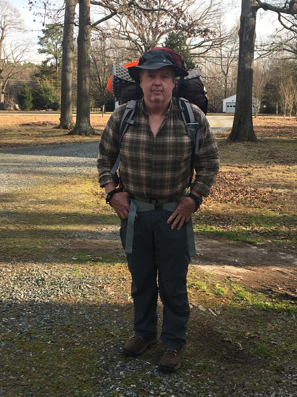
Need to finalize my equipment list... I have obtained most of it, now to start organizing the pack... Time is going by rather quickly...
[email protected]
Thanksgiving 2016!!! 24 November
January 30th is quickly approaching. I have registered to start my thru hike, purchased the gear needed, started boxing up food... watching long range weather forecast... looking into storage of my RV, Amtrak ticket to the Atlanta area and a shuttle from the station to Springer Mountain... so things are coming together, still not rushing, testing equipment, learning how it works etc...
(AS I RESEARCH THIS I CONTINUE TO ADJUST MY PLANS), already reduced anticipated miles per day by half, that has me anticpating 200 days of hiking, cost because I have found a wide range of estimates, some say $350. per month, others say $1000. plus per month, also going to look at my gear again (I do not want to purchase replacement gear except when I need to)
I have added cost of gear under its own page. As mentioned previously I am not endorsing any of this equipment, purchased after researching what I thought I needed... should any of my gear not meet expectation I will mention it. My cost is higher than most hikers would need because of my start date. If you hike with someone or as a group some of the cost could be shared, example cooking stove...
Registration opens up the end of November for next years Thru Hikers, 31 January 2017 is my tentative start date. I will take Amtrak from Ohio to Atlanta Georgia and get a shuttle to Springer Mountain, the southern start point.
The APPALACHIAN TRAIL CONSERVACY, a great source of information as well as a place looking for volunteers, groups of folks along the trail who maintain it, around 500 people my age or older have completed the trail as a Thru Hiker... (Completed the entire trail in one year)... The distance is 2180 miles. My goal is to safely enjoy the challenge while viewing parts of this country that are not easily accessed...
learned some valuable lessons from the Southern Tier trip, the biggest being if I wait until I am in shape it will never be accomplished. I have joined a gym (september 2016)Also the value of equipment, cheaper to pay more upfront... That is not to say I need the best but rather I need equipment suited for the challenge. While doing research I have found backpacks that list for over a thousand dollar... to many hours at Amazon to pay for something like that...
I have decided to go with both a gps map system which I will download covering the trail. "downloaded the map already" Shelters, towns, post offices, water stops, elevation, distance between points and many other useful tools. To go with this gps system I have also purchased a book:
Appalachian Trail Thru-Hikers' Companion
this book backs up in hard copy the information on the app. Of course I will google information to attempt to reduce the blunders that will occur. My iphone will be for backup info and a sense of security but will not be relied on this trip for my main source of information, keeping fully charged is just to much work.
The A.T. (Appalachian Trail) can be completed in several ways, south to north, north to south, completeing part of the trail from one direction then catching a ride to the other end and walk to where one left off... This method is normally done when it looks like a completion date of October 15th is not possible, at which time the end of the trail closes in Maine. I have decided to start as early in 2017 while keeping safety in mind as weather permits... Certain days in March and April see a high number of individuals and groups beginning their trek, this can causes overcrowding at the shelters which are first come first use. Starting earlier will require me to duplicate gear, starting with cold weather gear and switching to warm weather gear as the season changes from winter to spring to summer. My goal is to walk until 15 July or completion which ever happens first. Should i not complete the trip in 2017 then I will hopefully do so in 2018.
Updates will eventually appear here, do not plan on using FB as much as i did on the Southern Tier
The next six months will cover purchase of equipment, preparing boxes for mail drops, training etc. Hopefully I will be able to combine some of my training with work at Amazon. At this time I am at Amazon in Campbellsville Kentucky, I have so far averaged walking 10 miles per day at work...
Need to finalize my equipment list... I have obtained most of it, now to start organizing the pack... Time is going by rather quickly...
FROM THE SOUTHERN TIER TRIP,
can be found in the menu bar under
DAILY UPDATES
A cross country trip has been on my bucket list for years, a window of opportunity has presented itself and now is as good time as any to start. While a reason besides it being a challenge has never really presented itself to me, I would say a focus on depression and better education regarding such is as good as any reason. I know people who suffer needlessly because they are afraid to talk about it, do not have access to current information, lack of good qualified counselors who know what they are doing, medical facilities or most importantly people/family who support them. As a society we are behind in treating the illness, this can be seen in the way many of our younger generation commit outrages crimes, the abuse of prescription drugs as well as nonprescription by people who self medicate. The list is endless and the funding in my opinion is wasted and used inappropriately. Would hope that my trip can in some way encourage a dialog on the issues, better treatment, better education. I do not claim to have the answers only the illness, and my experience struggling with the issues surrounding depression and treatment for it over the past 40 years have been very enlightening.
Began preparing for this trip nine months ago while in Kansas. Training consisted of daily rides 20-50 miles, incorporating flat land as well as hills, off days were spent walking. Continued to train while working for Amazon in Kentucky, while not as rigorous I was able to get daily walks in, walking as many as 16 miles per day. This change in training will result in a transition back to the bike seat again, a painful adaptation. Adjusting to the hours devoted to daily rides, an average of 50 miles per day for approximately 3,100 miles. The Southern Tier is the shortest route across the states.
Hopefully I can complete the trip by 15 April, 2016. Somewhere around that time I must head to Glacier National Park area in Montana where I have a Camp Host job at a park near Glacier for the summer. The trip normally takes just over 2 months, I am allowing additional time for projected weather worse than usual this winter. My departure is from the east coast rather than the west coast, this hopefully will allow me to hit the mountains in the west when they are most likely to be free of snow. Departing from the east will also allow for additional conditioning prior to tackling those mountains.
I have researched routes, maps and equipment... Most of the equipment will be tested along the route. Numerous opinions can be found online, pros and cons. I purchased equipment that had mostly positive reviews but found that the reviews had no standard means of measurement but were opinion based. (One person would say a certain item did not work for them and the next claimed it worked great for them under the same conditions.)
I have decided to endure the weather at nights rather than staying in shelters/hotels so I can get a feeling for what early settlers had to deal with. Still, I have better transportation, better equipment, and access to an updated weather forecast. Most of my food supply will be purchased at stores along the way to reduce the weight being carried, laundromats will be used to help with hygiene, water will be carried, which becomes a challenge in the western states.
Maps of the complete Southern Tier route are no longer availiable, I managed to get five of the seven that make up a set. An atlas was purchased to compliment the partial set I obtained, and I will use the GPS on my phone when possible. I also will carry a wifi box and a solar charger. I do not expect to have cell phone reception all the time for I will be traveling back roads and the solar charger was one of the items with mixed reviews. Which is another reason to utilize my map reading skills.
As mentioned, I hope to average 50 miles per day, of course flat terrain will allow for a greater distance and the mountains will greatly reduce the miles traveled. Overnight stops will impact distance traveled per day as will weather which is my biggest concern for now, El Niño is suppose to have a negative impact for traveling by bicycle in the southern states this winter. I will soon find out.
Attempts to upload photos, notes on location, distance traveled, terrain, weather, stores, people etc weekly and if possible daily. Drop points for needed parts and an attempt for an extension on my 2015 federal tax.
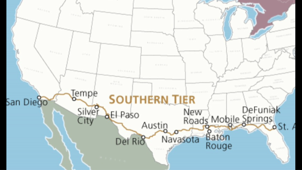
Southern Tier Route
The Southern Tier route consist of seven sections, purchased five of the seven sections I could find in print from Adventure Cycling Association I will deviate some to visit places of interest. I believe they have a GPS version of this route availiable or are in the process of making one availiable.
Section seven of The Southern Tier
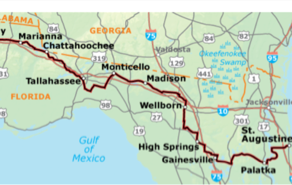
Above is section 7 of the southern tier, 409.5 miles long, I am going east to west so it will be my first section. Still on schedule to start 15 Jan 2016. Sending my bike and gear ahead next week via Amtrax and will hookup with it in Jacksonville
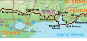
Section six of The Southern Tier
Section 6, 443 miles long. Section 7 and 6 are both considered flat, as is most of the trip until arriving in Austin Texas, west of Austin the Texas hill country begins. Hopefully by then I will have most of the issues I expect to encounter resolved.
Would like to answer a few questions about timing of the trip, weather etc.
While the Southern Tier is the shortest route constraints do exist. This time of the year the southern most states have a mild temperature. While this December has been very hard on people living in the area this is not normal for December. The temperatures are normally great for riding, evening thunderstorms are not as common now as when the temperature starts to warm up in a few months. My major concern has been and will be the western states. The desert states will soon be hot, as they warm up travel on a bike becomes strenuous, the amount of water I will have to strap onto my bike will increase. Those that have traveled this part of the country are familiar with the signs "NEXT SERVICE ---- MILES" I am actually starting a few weeks earlier than suggested for this trip but I am also allowing additional time. As can be observed from the map above the Southern Tier Route borders the future location of Trumps Great Wall of The South.
Please share this if you find it interesting. I can use the encouragement. This trip is funded solely by me, information I share is not an endorsement by either party or their equipment. Any opinions I give on equipment are mine, I purchased the equipment and if it works or fails to meet expectations I will let you know.
I have found for me "Adventure Cycling Association" has the most up to date information for the various cross country routes. I used their site for information and purchased my maps from them, still as I mentioned two sections were no longer in print, they attempted to locate me copies but were unable too at this time. I highly recommend them as a starting point for any trip, they have numerous tours if you do not want to do all the planning, other sites are out there but I find them the easiest to use, but then who am I.
For more information go to:
adventurecycling.org
01-01-2016
Boxed up my gear, fine tuned my bike, put some Kevlar tires on it, for the dogs I may encounter along the way. Taking the gear and bike to SC, shipping it to Jacksonville Florida this week, will join up with it on the 14th. Why SC; visit with Ethan before I start this adventure, he is my biggest motivator.
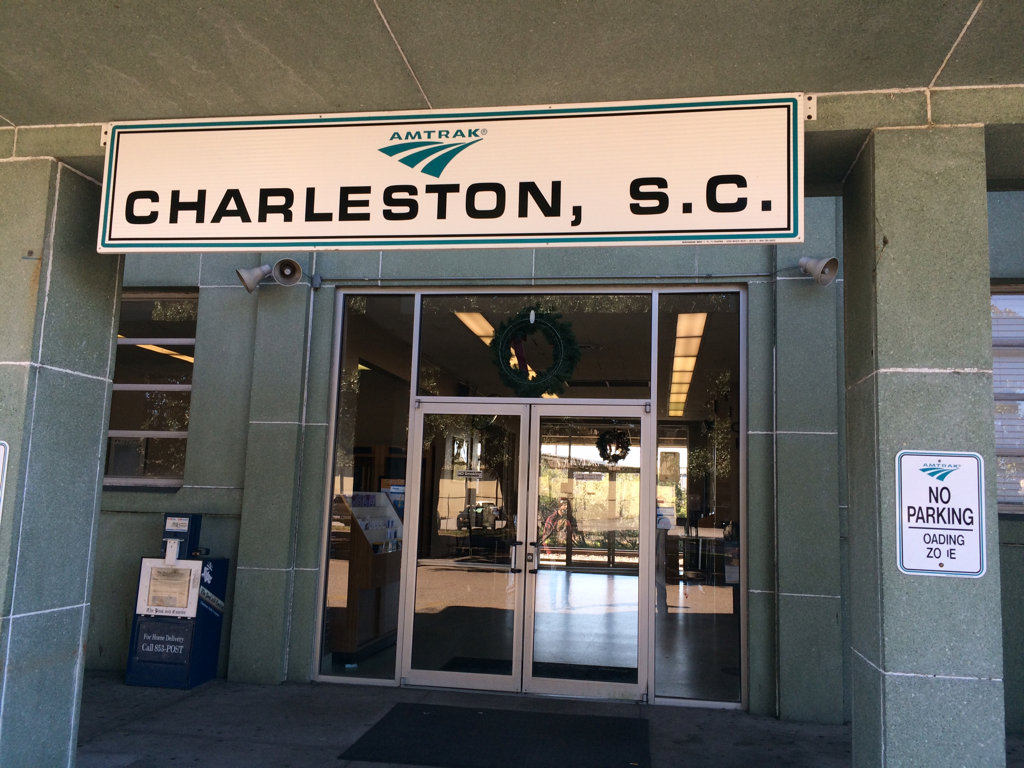
Amtrax Charleston South Carolina.
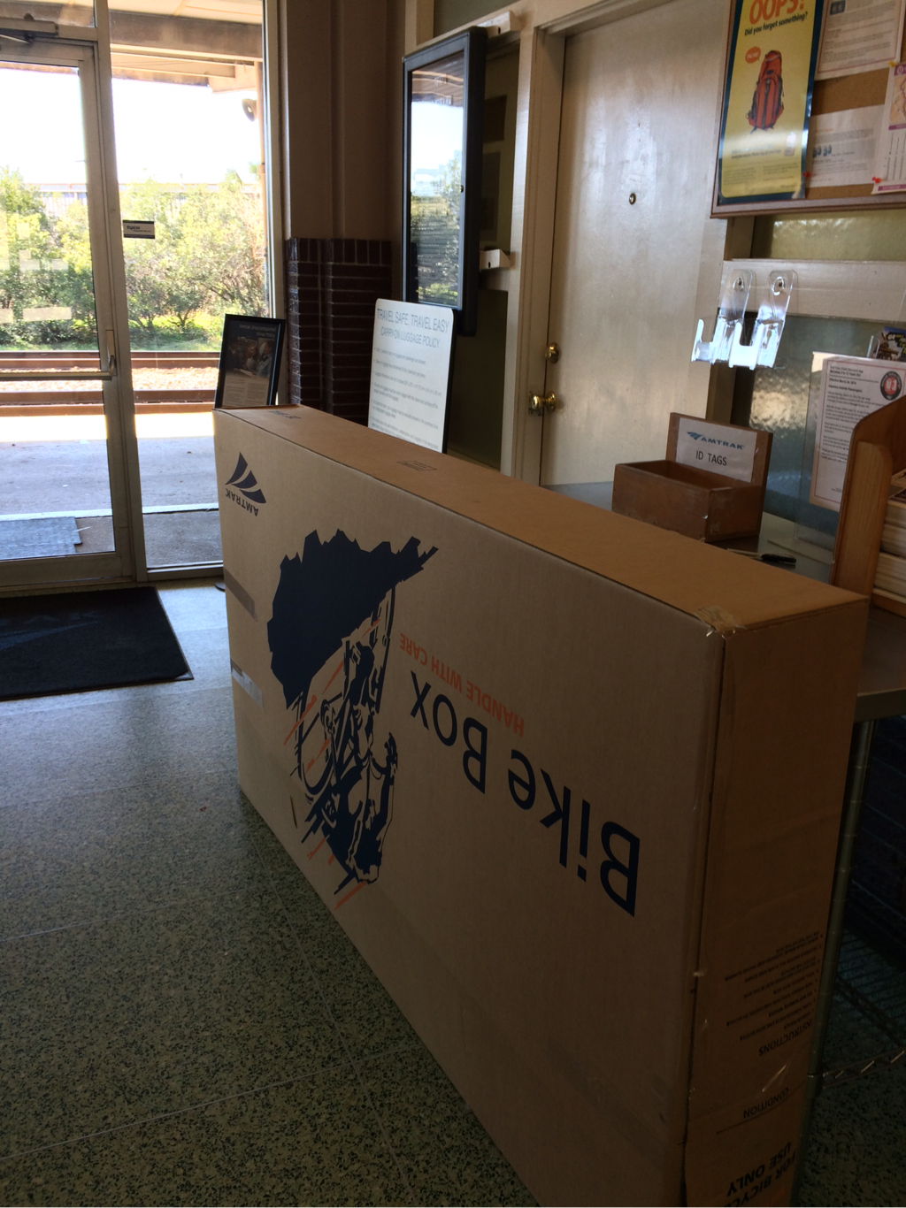
Bike boxed up upside down!!! Oops!!!
